
TL;DR Microsoft Bing Maps image metadata can be obtained via the Bing Maps API. Microsoft returns the image recording date as Vintage Start/End. Start and End are sometimes several years apart. VintageEnd is rarely the exact image recording date!
This blogpost is about Microsoft Bing Maps. More precisely, it’s about the recording dates of the very high resolution images which are available in Bing Maps.
To be honest, until recently I believed there was no easy way to get the exact dates of the images. Within the GUI there is no possibility and solutions such as the Bing Aerial Imagery Analyzer for OpenStreetMap are no longer available (The authors have deleted this site.) Are there any other options?
Bing Maps REST Services API
A quick google search leads us to the Bing Maps REST Services API Documentation which provides a interface to perform tasks such as creating a static map with pushpins, geocoding an address, retrieving imagery metadata, or creating a route.
… retrieving imagery metadata, BINGO, this is exactly what we need.
Get Imagery Metadata
Apparently, Microsoft provides URL templates to get metadata for imagery that is hosted by Bing™ Maps. The imagery metadata returned includes
- URLs and
- dimensions for imagery tiles,
- ranges of zoom levels (between 1 and 21), and
- imagery vintage information.
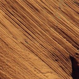
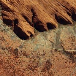
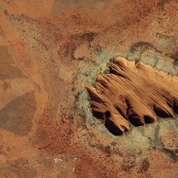
Here is a example URL to get the metadata of the Uluru (Ayers Rock) aerial image (top) located in central Australia (-25.345223, 131.035032) with zoom level 19.
To use the Bing Maps APIs, you must have a Bing Maps Key.
<!-- The request goes into the URL of your browser -->
https://dev.virtualearth.net/REST/V1/Imagery/Metadata/Aerial/-25.345223,131.035032?zl=19&o=xml&key=yourBingMapsKey

<ImageryMetadata>
<ImageUrl>
http://ecn.t3.tiles.virtualearth.net/tiles/a3103112120301310003.jpeg?g=6766
</ImageUrl>
<ImageWidth>256</ImageWidth>
<ImageHeight>256</ImageHeight>
<ZoomMin>19</ZoomMin>
<ZoomMax>19</ZoomMax>
<VintageStart>2010-12-27</VintageStart>
<VintageEnd>2014-07-14</VintageEnd>
</ImageryMetadata>
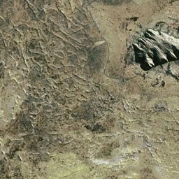
The ImageUrl bring us to the following image tiles. At zoom level 13-19, we see the same image. The image recording date is expressed in VintageStart (2010-12-27) and VintageEnd (2014-07-14).
 Zoom: 21, Not available
 Zoom: 20, Not available
 Zoom: 19
 Zoom: 18
 Zoom: 17
 Zoom: 16
 Zoom: 15
 Zoom: 14
 Zoom: 13
 Zoom: 12, 1999-01-01 - 2003-12-31
A few months ago, when I tried this, I was very disappointed. The dates for the image recording were almost three and a half years apart.
- Vintage Start: 27. December 2010
- Vintage End: 14. July 2014
“Useless!!!”, that was my first thought. What am I supposed to do with this? I haven’t wasted another thought on the issue, never used Bing Maps again, and went straight back to Google Earth.
Science Twitter
This week I saw a tweet from Mike Wulder
Need high res image data to interpret for your #landcover accuracy assessment?
— Mike Wulder (@mikewulder) November 28, 2018
Lesiv etal. Characterizing the Spatial & Temporal Availability of Very High Resolution Satellite Imagery in Google Earth and Microsoft Bing Maps as a Source of Reference Data.https://t.co/6k3le7nWE4 pic.twitter.com/q9mIA1bkGY
about an article. In the method section of the article it says:
"The dates of the images were extracted from Google Earth and Microsoft Bing Maps using the API provided by each application ....">
I wrote the co-authors, who programmed the data collection from Google Earth and Microsoft Bing Maps, and they confirmed that they used the Bing Maps REST Services API - “Vintage End” as date of the most recent very high resolution satellite imagery.
VintageEnd is the solution!?
And then it made click. Of course, the “Vintage End” date must be the exact date for the image at the appropriate zoom level. It must be like this. It cannot be any different.
But if “Vintage End” is the date of the image, what does “Vintage Start” stands for? The Bing Maps Documentation doesn’t mention anything specific.
To confirm my new insight, I have looked for places that show more changes than the Uluru rock. As reference, I used Google Earth photos were we know the image recording dates. I selected Google Earth images recorded shortly before and/or after the Bing Map images.
Example 1: Berlin (Germany)
The first example is the construction site of the Berlin castle in Mitte.
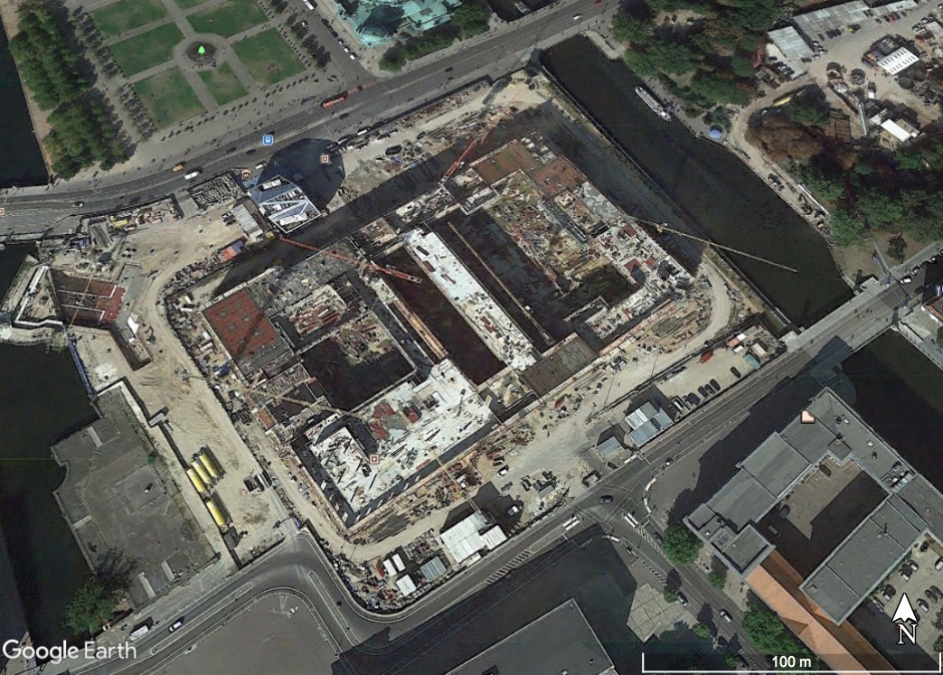 Google Earth image from 4. September 2014
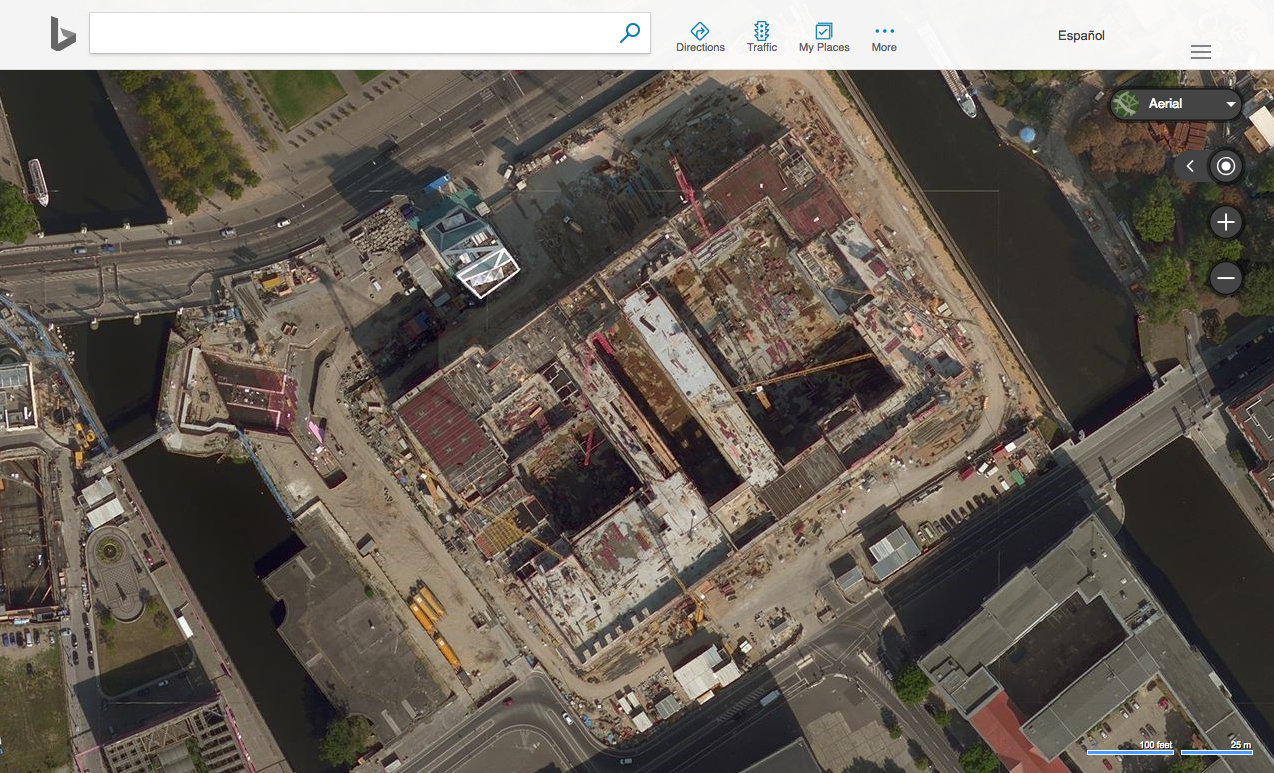 Bing Maps, VintageStart 5. Sept. 2014 - VintageEnd 6. Sept. 2014
The images were taken almost at the same day. On the construction site, many materials can be seen in both pictures in the same place.
And even more surprising, the VintageStart and VintageEnd are very close to each other (1 day). From this example we cannot know which is the right date. It could be any of the two.
Example 2: Buenos Aires (Argentina)
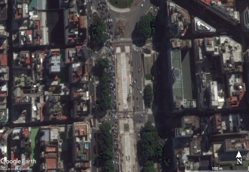
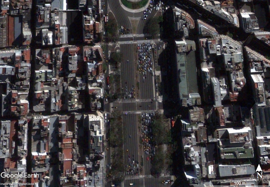
Just south of Plaza de la Republica right in the city center is Avenida 9 de Julio, one of the widest avenue in the world. In order to relieve the traffic a little, an express bus line was built in the middle of the center line of the avenue. This is where we focus now for a moment.
Google Earth documents the construction process very well, we have 1 image right before the construction is starting, 3 images during the construction and 1 hazy image afterwards.
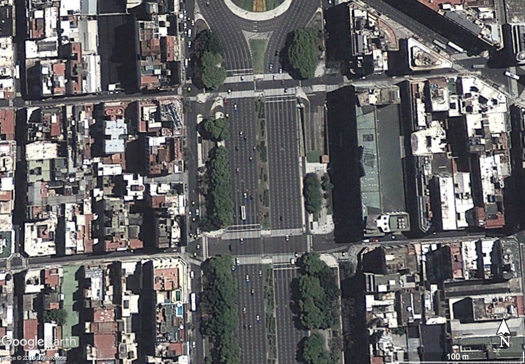 Google Earth image from 1. December 2012 - Before Constructions
 Google Earth image from 4. February 2013 - During Constructions
 Google Earth image from 12. April 2013 - During Constructions
 Google Earth image from 13. June 2014 - After Constructions
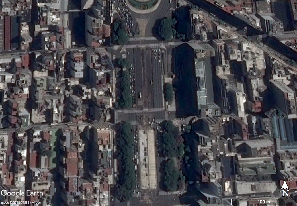
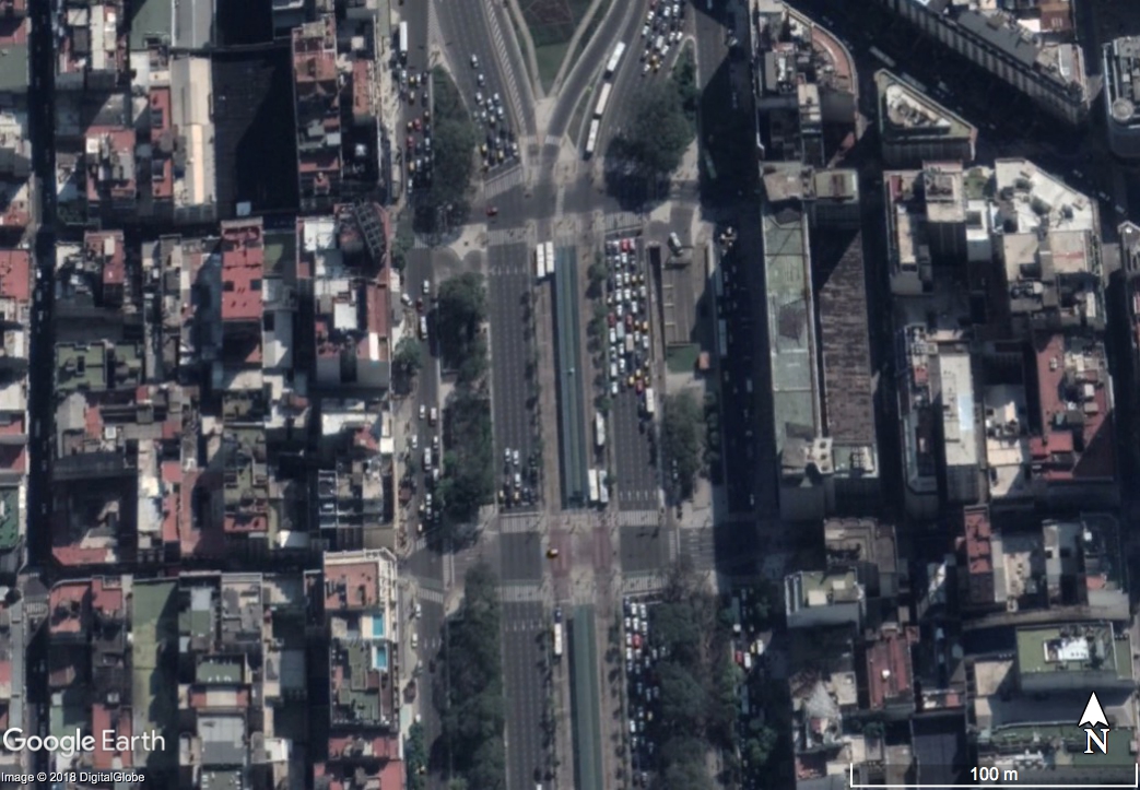
 Bing Maps image recorded between 31.12.2009 and 21. November 2013??
The Bing Maps imagery shows the avenue before the bus express line was established. The Vintage dates say Start: 2009-12-31 and End 2013-11-21.
Hopla, November 2013 (Vintage End), but there is no sign of a bus express line! The correct recording day must (should) be before April 2013, right?
What about the other date, the Vintage Start?
I have my doubts that the picture was taken in December (31.12.2009), because it would mean its summer over there. You can clearly see that some trees are without leaves, you would expect that to happen in winter. Like in the Google Earth picture of mid September.
 Google Earth image recorded on the 16. September 2010
Example 3: Amazonas (Brazil)
As last example serves a deforesation place in State Rondonia (Brazil) southwest of the province capital Porto Velho. Google Earth has no very high resolution image available and offers ‘only’ Landsat images.
<!-- The request goes into the URL of your browser -->
https://dev.virtualearth.net/REST/V1/Imagery/Metadata/Aerial/-10.085329,-64.827476?zl=10&o=xml&key=yourBingMapskey

<ImageryMetadata>
<ImageUrl>
http://ecn.t1.tiles.virtualearth.net/tiles/a2101022311.jpeg?g=6766
</ImageUrl>
<ImageWidth>256</ImageWidth>
<ImageHeight>256</ImageHeight>
<ZoomMin>10</ZoomMin>
<ZoomMax>10</ZoomMax>
<VintageStart>1999-01-01</VintageStart>
<VintageEnd>2003-12-31</VintageEnd>
</ImageryMetadata>
Bing Maps suggest the image was taken between:
- Vintage Start: 1. January 1999
- Vintage End: 31. December 2003
Here, I sort the Google Earth and Bing Maps images in my personal logical order.
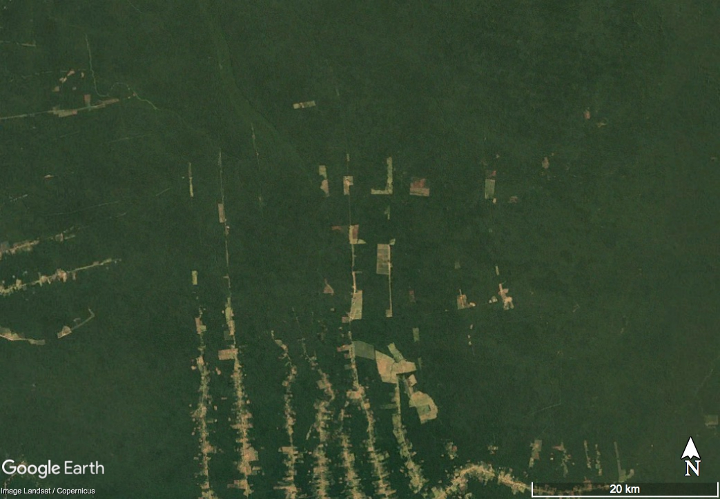 Google Earth image from December 1999
- The Bing Image must have been record after December 1999 because the new forest track (red rectangle) exists already.
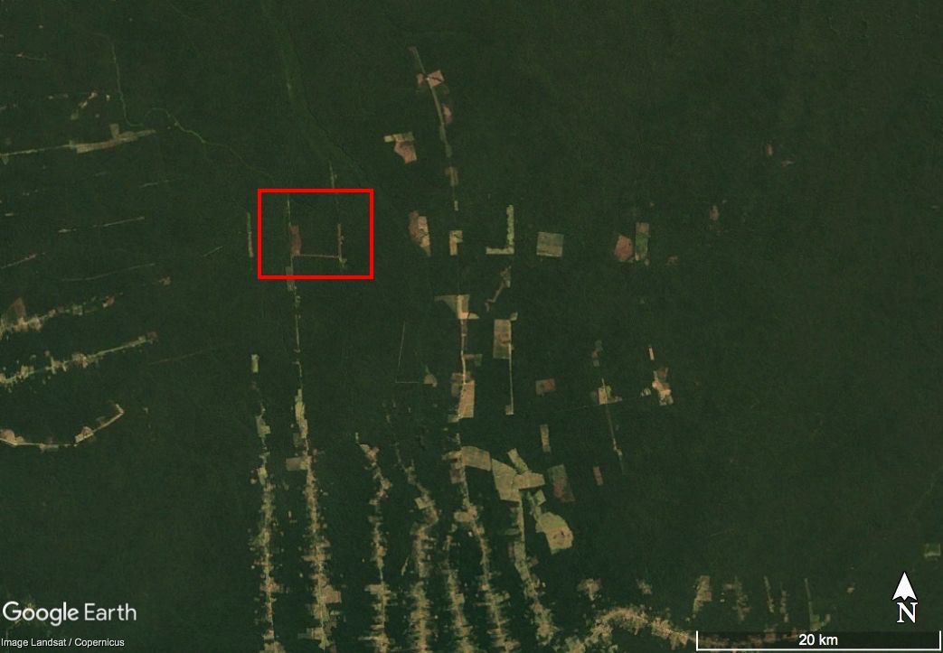 Google Earth image from December 2000
- The Bing Image must have been record after December 2000 because the small clearing (blue rectangle) doens’t exist in the GE image from December 2000.
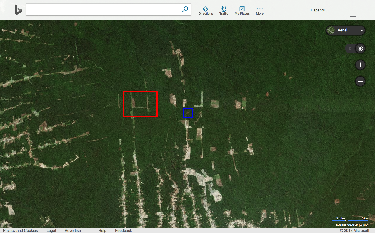 Bing Maps image
- The Bing Image must have been record before December 2001 because the small clearing (blue rectangle) is in the Google Earth image from December 2001 much bigger.
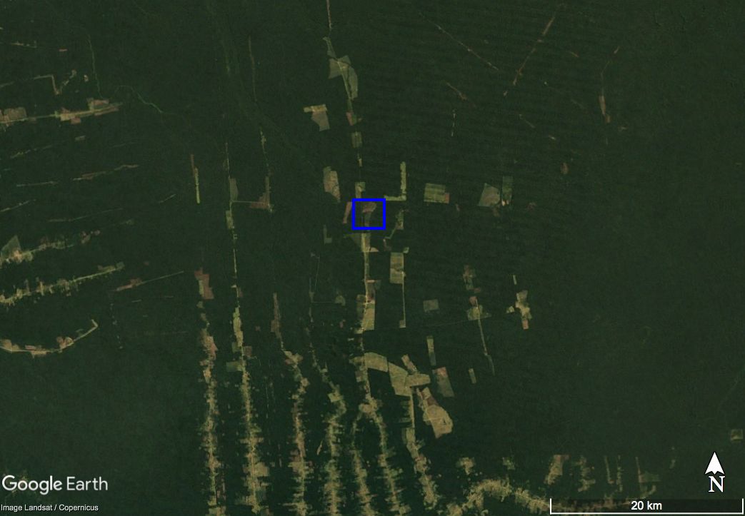 Google Earth image from December 2001
I believe the Bing Maps image is taken after December 2000 and before December 2001. Meaning, neither the “VintageStart” nor the “VintageEnd” is correct.
Bottom Line
I am sure the are plenty of other locations were the “VintageEnd” is correct and I am cherry-picking places here. This is not ment to prove anyone wrong, neither right.
Its just for myself to understand the possibilities or limitations of Bing Maps for my own project. During my work, we are desperatly looking for free very high resolution imagery in NW Argentina, to document forest degradation and having on more options, beside Google Earth, would be terrific.
You can cite this blogpost using: Gärtner, Philipp (2018/11/30) “How accurate are the recording dates for images in Microsoft Bing Maps?”, https://philippgaertner.github.io/2018/11/microsoft-bing-maps/
If you have any questions, suggestions or spotted a mistake, please use the comment function at the bottom of this page.
Previous blog posts are available within the blog archive. Feel free to connect or follow me on Twitter - @Mixed_Pixels.